Import canonical records
Create canonical locations from a GeoJSON file. This walkthrough uses a file of U.S. states.
You'll learn
- How to validate a GeoJSON file.
- How to map source properties to canonical fields.
- How to review and exclude records before importing.
- What to inspect after a completed import.
Before you begin
You need editing access to Tutorial Stylebook and the sample
us_states.json file.
The sample is a valid GeoJSON FeatureCollection containing 52 features. Each
feature has Polygon or MultiPolygon geography and these properties:
NAMESTATEGEO_IDLSADCENSUSAREA
Keep the source file. A completed import does not have a one-click rollback.
1. Open the location importer
Open Tutorial Stylebook → Locations → Canonical locations, then select Import.
Stylebook uses different bulk formats for different canonical types:
- locations use GeoJSON;
- people and organizations use CSV.
Imports create canonical records directly. They do not create article mentions or pass through the candidate queue.
2. Upload and validate the file
Choose the GeoJSON file. Stylebook accepts .geojson and .json files up to
25 MB. Select Validate.
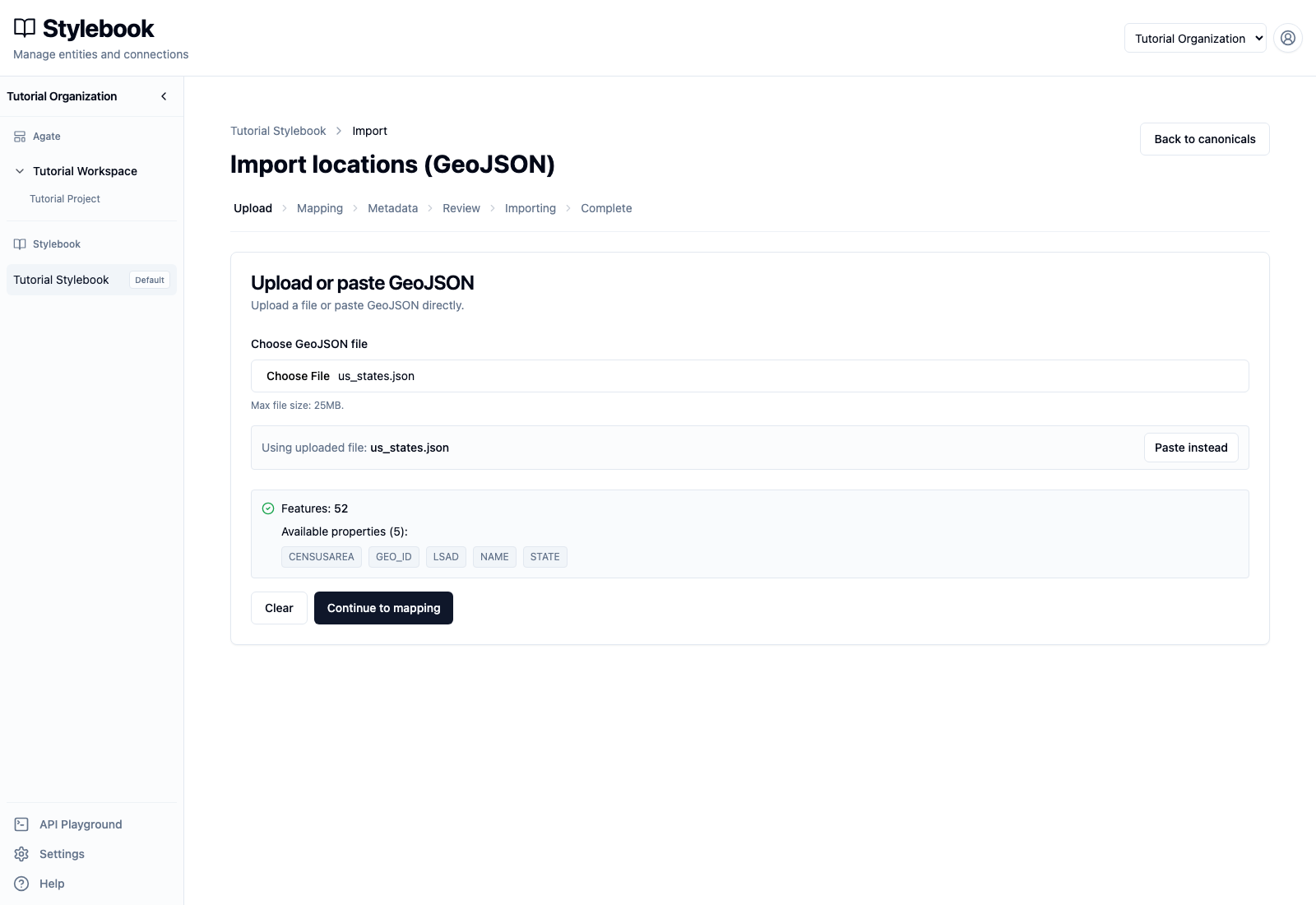
The sample reports:
- 52 features;
- five available properties;
- no file-level validation error.
Validation confirms that Stylebook can parse the file. It does not confirm that the labels, types, geometry, or records are editorially correct.
Select Continue to mapping.
3. Map canonical fields
Use these mappings:
- Label / name property:
NAME - Formatted address property: leave at its default
- Location type:
State
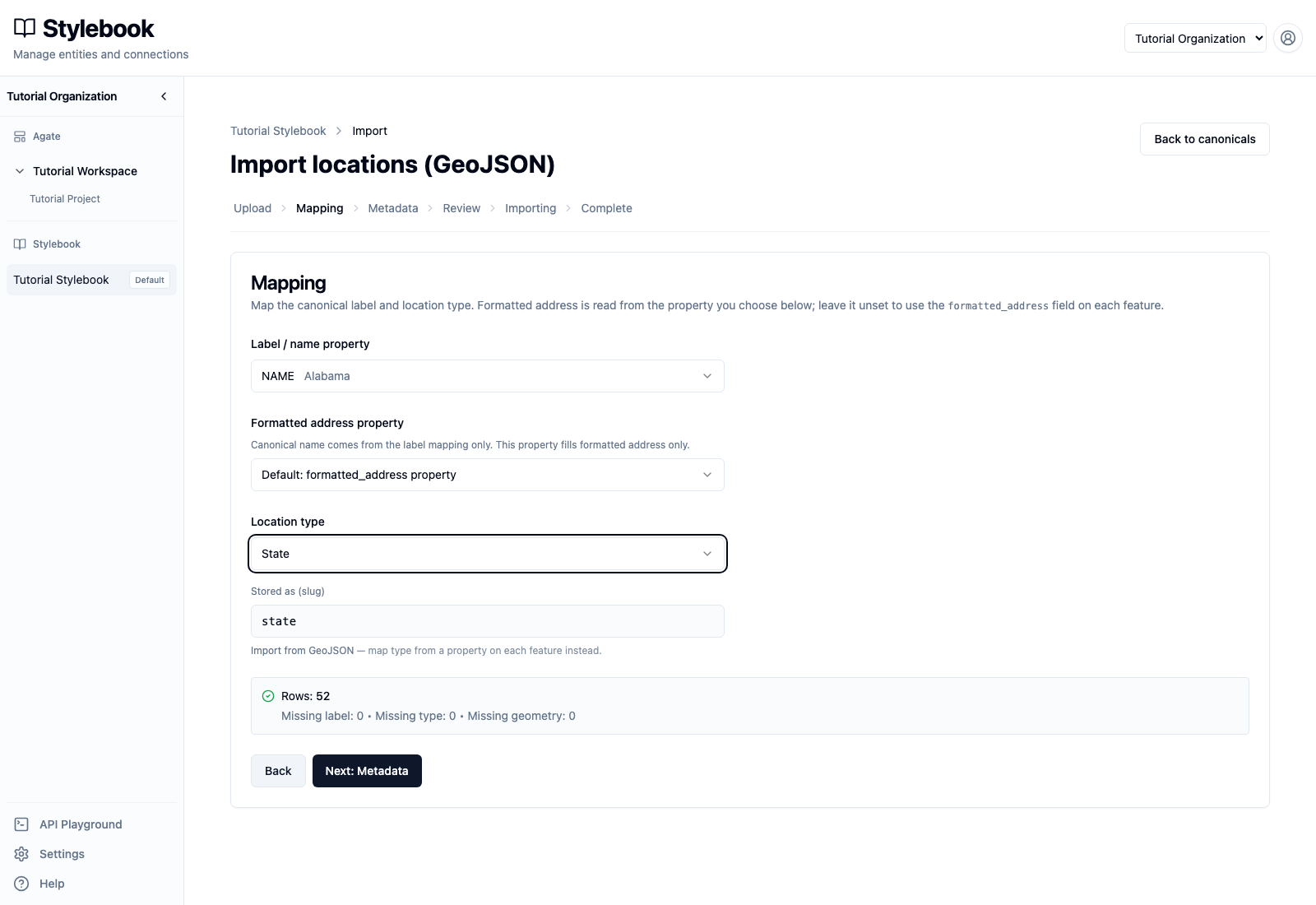
The importer now reports:
- Missing label: 0
- Missing type: 0
- Missing geometry: 0
Do not use the STATE property as the location type. Its values are numeric
state codes, while every feature in this file should receive the canonical type
state.
Select Next: Metadata.
4. Decide whether to add metadata
Metadata mapping is optional. Each mapping stores one scalar GeoJSON property as a typed attribute on the imported canonical. Nested or non-scalar property values are skipped.
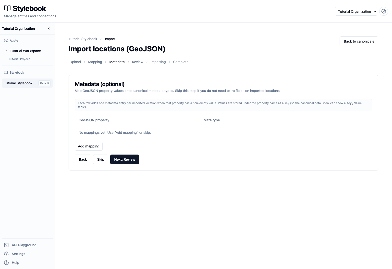
Skip metadata for this walkthrough. Properties such as CENSUSAREA can be
useful, but only after the newsroom has documented the value's units, source,
meaning, and maintenance plan. Importing an unexplained number creates future
cleanup work.
Select Skip.
5. Review every record
The review table contains all 52 proposed canonicals. Check:
- the label;
- the normalized type slug,
state; - optional formatted address;
- Polygon or MultiPolygon geometry;
- the Skip box for records that should not be imported.
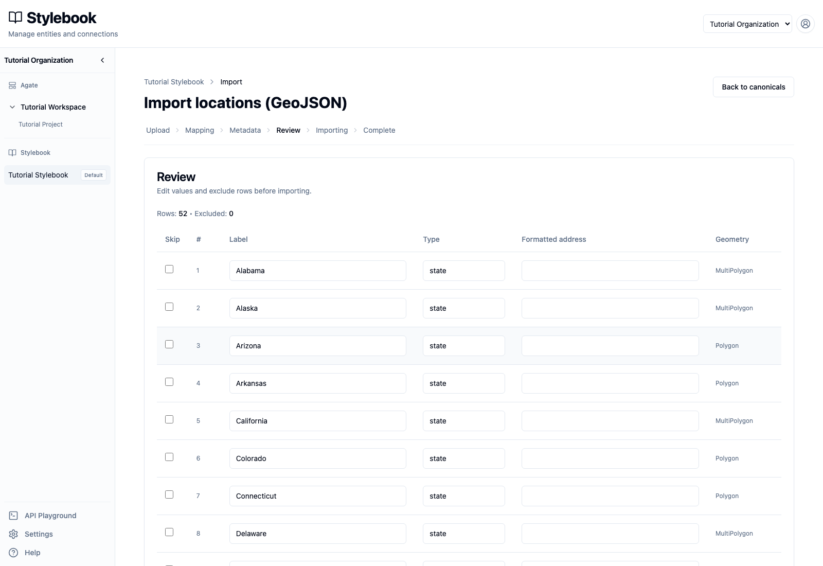
Values can be edited in this table before import. The final rows include Wyoming and Puerto Rico, confirming that this is a 52-feature source rather than a list containing only the 50 states.
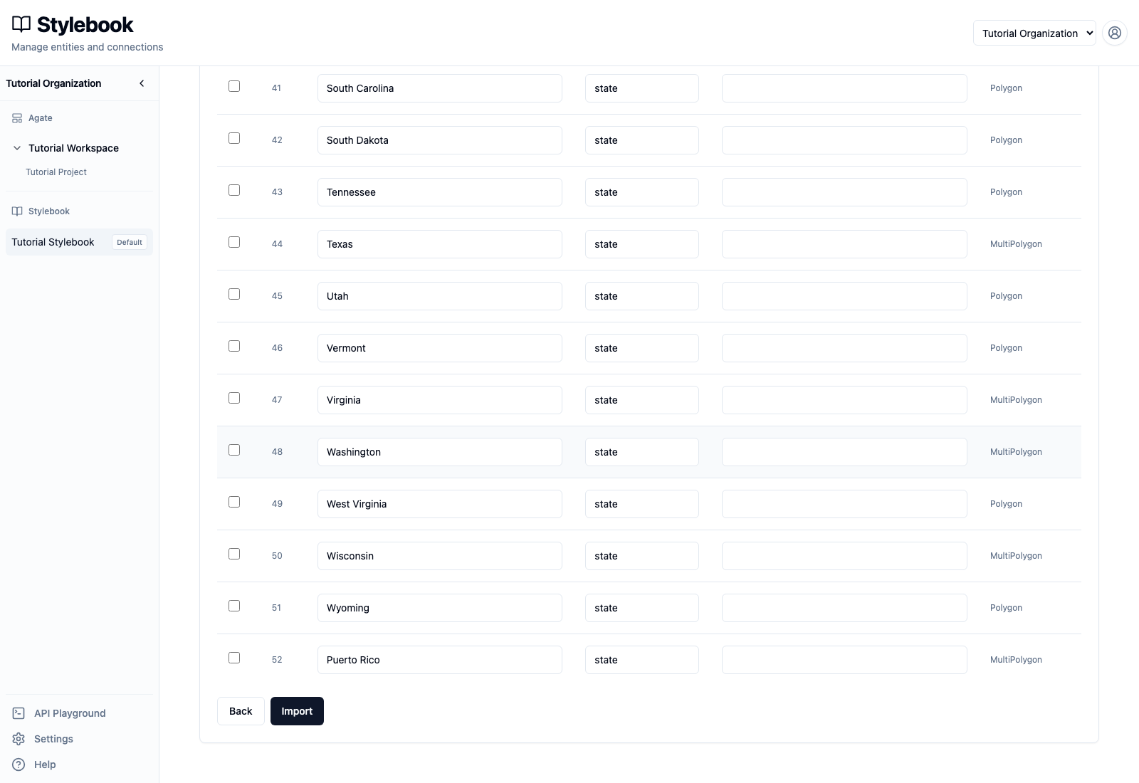
When the review is complete, select Import. Keep the page open while Stylebook processes the file, then review the totals shown on Complete.
6. Inspect an imported canonical
Return to Canonical locations, search for Minnesota, and open the result
whose type is State.
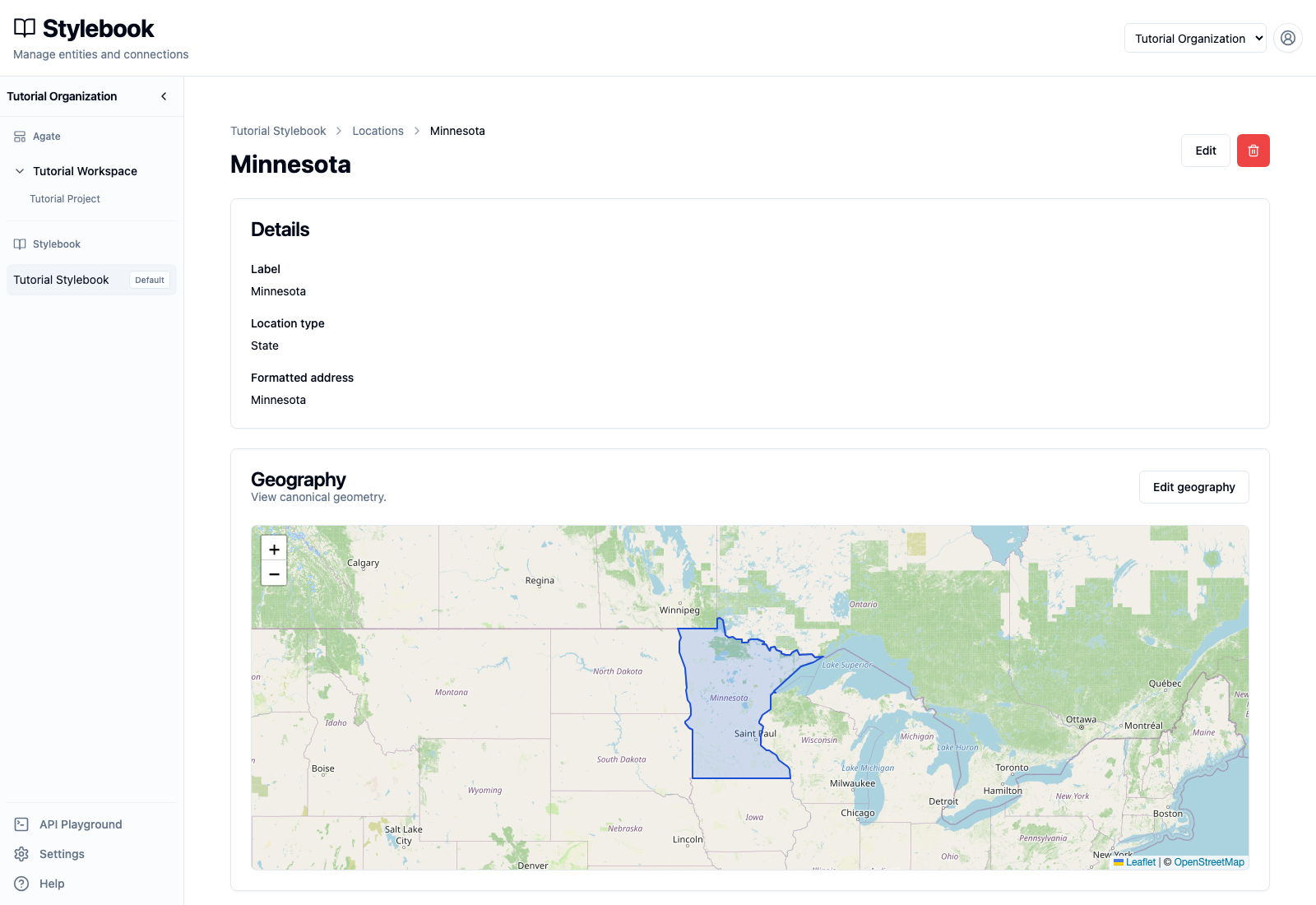
Confirm that the canonical has:
- label
Minnesota; - location type
State; - formatted address
Minnesota; - state boundary geometry.
The mention shown on this record came from a later article. The geographic import created the canonical and its geometry; imports do not create mentions.
After import
Inspect several records immediately, including one Polygon and one MultiPolygon. Search for similarly named canonicals and run the relevant Stylebook quality checks. Import validation does not deduplicate records that already exist.